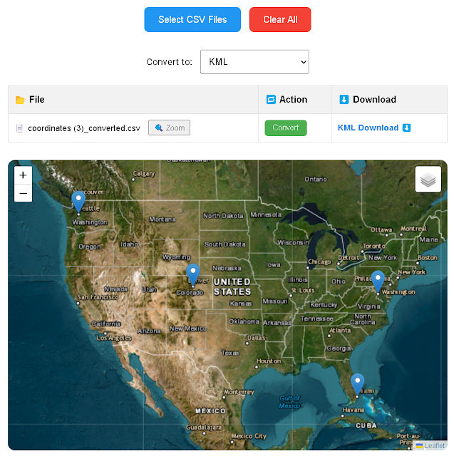
Convert CSV files to GeoJSON, KML, GPX, Excel, and more. Secure, browser-based tool with no uploads required
Looking for a fast and secure way to convert your CSV files into geospatial formats without the need for map previews? Try our lightweight CSV File Converter on convert.geojamal.com – the fastest tool to export your latitude and longitude data into GeoJSON, KML, GPX, Excel (.xlsx), TXT, WKT, and more, all in-browser with no file uploads. If you're working with tables embedded in Word documents and need to extract them efficiently, check out our tool to extract tables from Word .docx files to Excel or CSV — perfect for document-based data extraction workflows.
🚀 Why Use This CSV Converter?
- Ultra-fast conversion without internet dependency – your files stay private.
- Supports 14+ export formats used in GIS, GPS, and mapping applications.
- Batch processing for multiple CSV files.
- 100% browser-based – no server, no data tracking.
- Clean interface for bulk conversion without map previews.
Whether you're working with field-collected data, drone coordinates, or survey files in spreadsheets, this tool gives you full control over your output format and data structure.
📤 Supported Export Formats
| Format | Description | Use Case |
|---|---|---|
| GeoJSON | JSON format for encoding a variety of geographic data structures. | Web mapping applications like Leaflet and Mapbox. |
| KML | XML format for representing geographic data for applications like Google Earth. | Visualizing data in Google Earth. |
| GPX | GPS Exchange Format for storing GPS data. | GPS devices and tracking software. |
| Excel (.xlsx) | Spreadsheet format for tabular data. | Data analysis and sharing in Excel or Google Sheets. |
| TXT / ASCII / TSV | Plain text formats with configurable separators. | Lightweight data exports and integrations. |
| WKT / GML / XML | Formats for representing vector geometry objects. | Advanced GIS processing and metadata applications. |
| TopoJSON / TileJSON / STAC JSON | Formats for web map tiling and structured spatial data catalogs. | Web-based geospatial workflows and data catalogs. |
🌍 Need Map Preview?
If you prefer a version with interactive map visualization before exporting, try our enhanced tool at:
👉 Convert and Visualize CSV on Map
🔗 Explore More Tools from GeoJamal
- 🛠️ CSV to Geo Format Converter (No Map)
- 🌍 CSV to Map Converter + Export
- 📍 Visualize DMS Coordinates on Map
- 📷 Extract GPS Coordinates from Photos
- 🔄 Batch DMS to DD Converter
Frequently Asked Questions (FAQ)
✅ What format should my CSV have?
Ensure your CSV includes latitude and longitude columns. Other accepted forms: lat / lon, or Lat / Lng.
✅ Is this converter secure?
Yes. All conversions are handled entirely in your browser. No data is uploaded or logged.
✅ Can I convert multiple CSV files?
Absolutely. You can upload and convert files one after another without refreshing the page.
✅ Where can I preview my coordinates on a map?
Use the map-based version at coordinates.geojamal.com for full visual analysis.


